Festival map
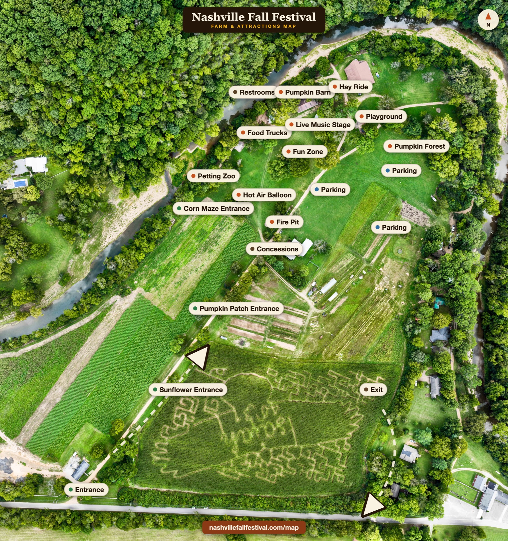
Where everything is
Corn maze, sunflowers, the pumpkin patch, the barn, hayrides, food, and parking — the whole 70-acre farm at a glance.
Entrance
Bottom-left, right off Old Harding Pike. Start here.
Parking
Free lots on the right side of the grounds.
Exit
On the right, past the parking lots.
Restrooms
Up top, by the food trucks and live music stage.
Tip: tap the map to zoom, or download it to your phone before you lose signal on the farm.
This year’s maze
The corn maze
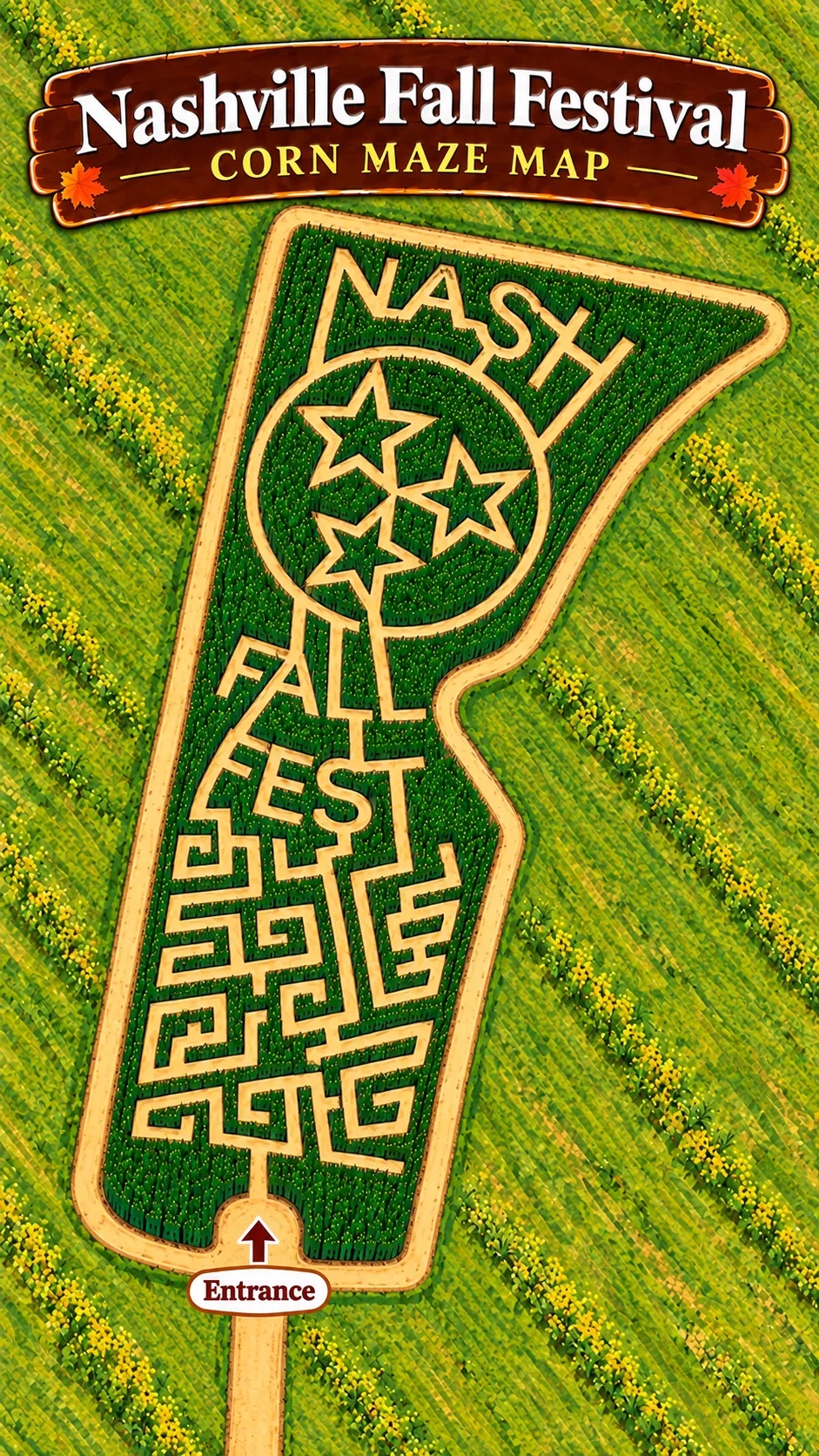
The maze is cut into a Tennessee tristar and the words “NASH FALL FEST.” Here’s the path in from the entrance. Snap a photo before you head in, or see if you can solve it without one.